   |
|||||||
Redistricting of School Board Member Voting Districts DOES NOT impact student attendance boundaries or transportation. |
|||||||
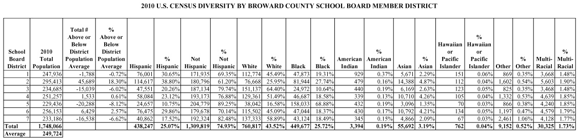
School Board Member District PopulationsThe current Broward County School District Map was adopted in December 2001 based upon 2000 Census data. Since 2000, the County’s population has shifted significantly, resulting in population inequities among the seven districts. Population in the eastern portion of the County has decreased, while population in the southwestern portion of the County has grown dramatically. As a result, the district populations are no longer consistent with the generally accepted redistricting principle that district populations should not vary more or less than five percent from the average. Florida Law requires that the population in each district be “as equal as is practicable.” The 2010 U.S. Census data is being used to analyze the population and demographic characteristics in each single member district. In addition, existing voter tabulated districts will be used to avoid voter confusion with split districts.
|
|||||||